How to Create Interactive Route Maps in WordPress Using OpenStreetMap
How to Create Interactive Route Maps in WordPress Using OpenStreetMap
Create beautiful interactive route maps in WordPress using OpenStreetMap and structured content. Learn how to build multi-stop routes with ACF and Baxtersweb Maps.
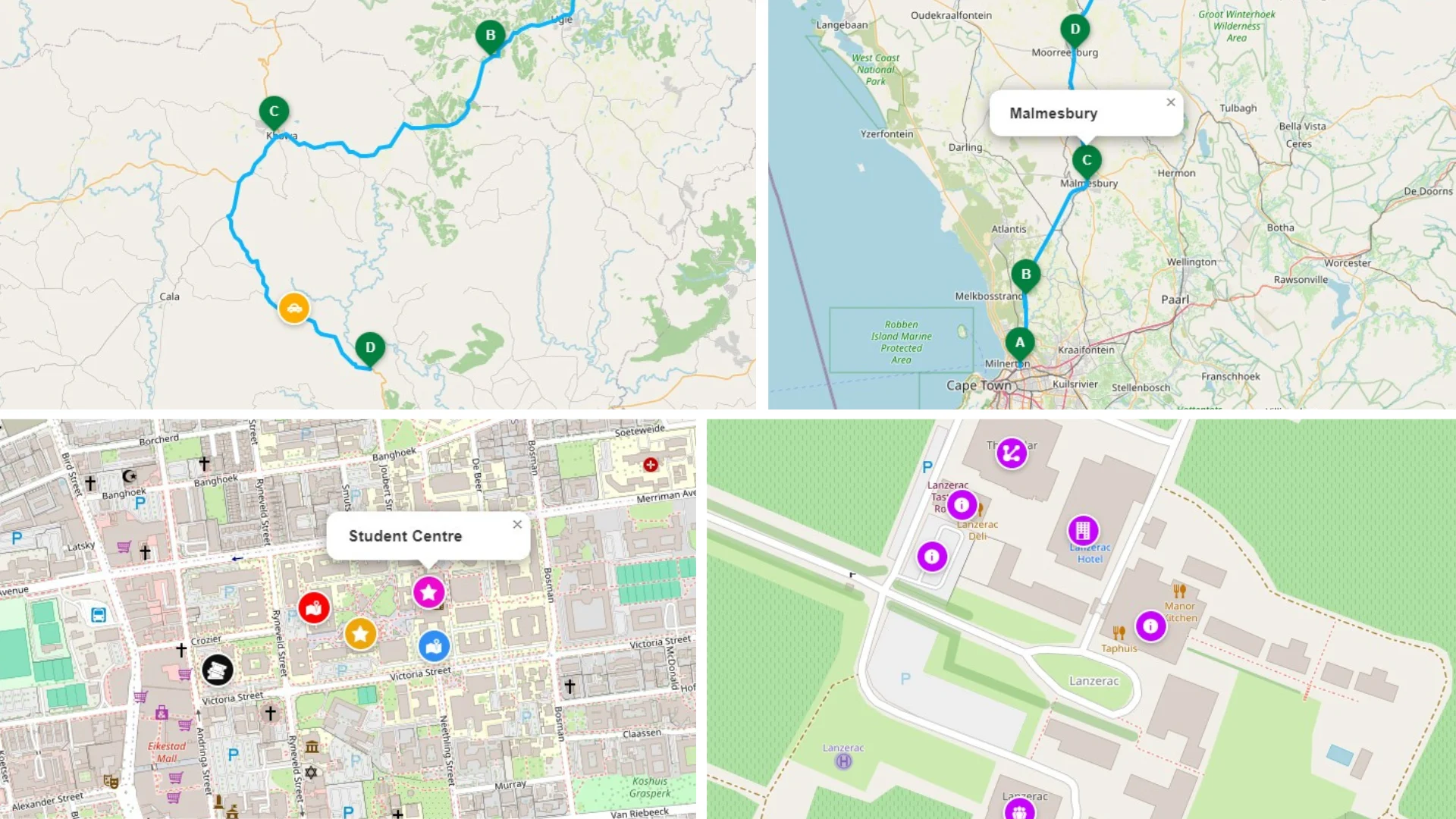
Whether you’re building a travel itinerary, mapping a safari route, showcasing delivery areas, or creating an interactive visitor guide, an embedded Google Map often isn’t enough. In this guide I’ll show you how to create beautiful, interactive route maps in WordPress using OpenStreetMap and structured content, making your maps easier to manage, easier to update, and far more useful to your visitors.
Contents
- Why a simple embedded map isn’t always enough
- What makes an interactive route map different?
- Why I chose OpenStreetMap
- Common uses for interactive maps
- What you’ll need
- Installing Baxtersweb Maps
- Creating your first route
- Adding locations with ACF
- Displaying the map on your website
- Styling your maps
- Tips for managing larger routes
- Frequently Asked Questions
Why a Simple Embedded Map Isn’t Always Enough
One of the first things many WordPress users do is embed a Google Map onto a page.
It works well if all you need is a single office location or a contact page. But once your content becomes more detailed, those embedded maps start showing their limitations.
Imagine you’re creating:
- a multi-day safari itinerary
- a cycling route
- a hiking trail
- a wine tasting journey
- a property development tour
- a delivery route
- a road trip through South Africa
These aren’t just locations—they’re journeys. Each stop has its own title, description, image, and purpose.
Instead of displaying a single pin, you need to tell a story.
That’s where interactive route maps become incredibly useful.
Rather than treating the map as a separate widget, the route becomes part of your website’s content. Every location is stored alongside the rest of your WordPress data, making it much easier to edit, update and reuse.
What Makes an Interactive Route Map Different?
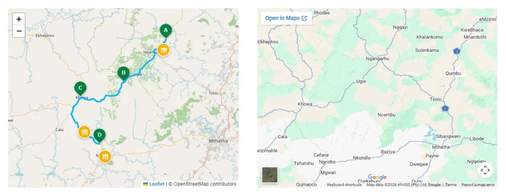
An interactive route map is more than a collection of markers.
It combines structured information with an interactive map to guide visitors through a sequence of locations.
Instead of simply answering “Where is this place?”, it helps answer questions like:
- Where do I start?
- What comes next?
- How many stops are there?
- What should I expect at each location?
- How far does the route travel?
- Which places are points of interest rather than actual route stops?
For example, imagine a wine estate website.
Instead of embedding a single vineyard location, you could create a route that includes:
- Main entrance
- Tasting room
- Restaurant
- Cellar tour
- Picnic area
- Accommodation
Visitors immediately understand the experience before they even arrive.
The same principle applies to travel operators, schools, event organisers, agricultural businesses and many other industries.
Why I Chose OpenStreetMap
Whenever I build websites involving maps, one question almost always comes up:
“Why not just use Google Maps?”
Google Maps is an excellent product, and for many projects it’s still the right choice.
However, I wanted something that gave website owners more flexibility over how their own content is displayed.
OpenStreetMap provides exactly that.
It’s an open mapping project maintained by contributors around the world and supported by a huge ecosystem of mapping tools and libraries.
Using OpenStreetMap allows you to build custom mapping experiences without being limited to a simple embedded iframe.
Some of the advantages include:
- Clean, modern map tiles
- Excellent worldwide coverage
- Easy integration into custom WordPress websites
- Flexible styling
- Works beautifully with Leaflet, one of the most popular JavaScript mapping libraries
The result feels like part of your website rather than a third-party widget.
Common Uses for Interactive Route Maps
One of the things I enjoy most about building mapping solutions is seeing how differently each client uses them.
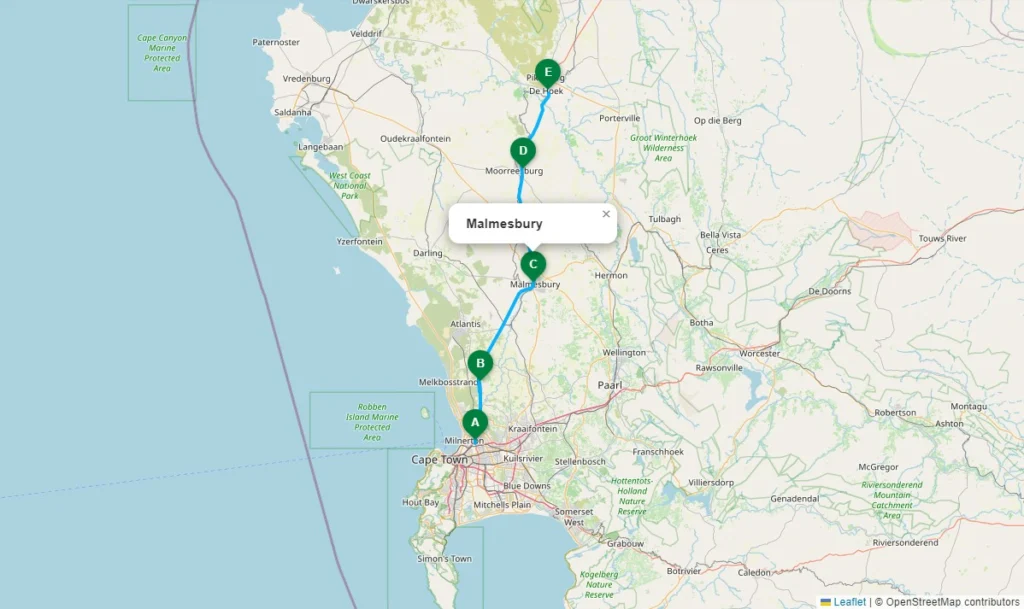
Although Baxtersweb Maps was originally created around travel routes, it quickly became obvious that the same approach works for many different industries.
Some examples include:
Tourism Websites
Perfect for:
- self-drive routes
- guided tours
- holiday itineraries
- wine routes
- hiking trails
- cycling routes
Each destination becomes its own stop with photographs, descriptions and additional information.
Safari Operators
Instead of displaying a generic lodge location, you can map:
- Day 1 camp
- Game drive stops
- Picnic locations
- Scenic viewpoints
- Overnight camps
- Final destination
Visitors immediately understand the journey they’ll experience.
Schools and Universities
Interactive campus maps work exceptionally well.
Examples include:
- Reception
- Administration
- Boarding houses
- Sports facilities
- Parking
- Auditorium
- Cafeteria
Rather than showing a static campus plan, visitors can explore the site interactively.
Agricultural Businesses
This is particularly useful for larger farming operations.
For example:
- Main office
- Grain silos
- Workshops
- Loading areas
- Irrigation points
- Livestock facilities
Because the data lives inside WordPress, updating locations becomes much simpler than editing graphics every season.
Events
Events often span multiple locations.
Examples include:
- Registration
- Main stage
- Food court
- VIP area
- Parking
- Medical station
- Exit points
An interactive map helps visitors navigate far more easily than a static PDF.
Property Developments
Developers can showcase:
- Entrance
- Clubhouse
- Parks
- Walking trails
- Available plots
- Show house
Each location becomes an interactive information point.
What You’ll Need
Before creating your first route, you’ll need a few things already installed on your WordPress website.
WordPress
Naturally, you’ll need a working WordPress website.
Advanced Custom Fields Pro
Baxtersweb Maps uses ACF Pro to store your route locations in a structured repeater field.
This keeps your content organised and makes editing routes incredibly straightforward.
Instead of manually editing code or map files, you simply add another row to the repeater.
ACF OpenStreetMap Field
To select locations directly from a map, you’ll also need the ACF OpenStreetMap Field plugin.
This allows editors to click on a map and save accurate coordinates without needing to look up latitude and longitude manually.
Baxtersweb Maps
Finally, install the Baxtersweb Maps plugin.
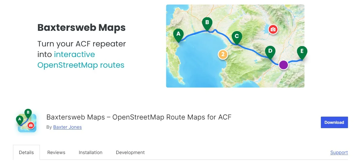
The plugin takes your structured ACF data and transforms it into an interactive route complete with:
- connected routes
- lettered markers
- optional points of interest
- responsive layouts
- OpenStreetMap integration
Installing Baxtersweb Maps
Installing the plugin is exactly the same as any other WordPress plugin.
- Go to Plugins → Add New
- Search for Baxtersweb Maps
- Install the plugin.
- Activate it.
If you’re using the version from the WordPress Plugin Directory, you’ll also find links to the documentation, demo site and plugin page directly from the plugin listing.
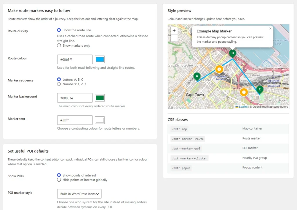
Once activated, you’ll see the Baxtersweb Maps settings page under Tools where you can configure items such as:
- default marker colours
- map height
- route styling
- preview settings
The plugin also includes a live preview so you can immediately see how your styling changes affect the map.
Creating Your First Route
Now comes the enjoyable part.
Rather than creating markers manually on the front end, we’ll build the route as structured WordPress content.
Imagine you’re creating a simple weekend road trip.
Your route could contain five stops:
A – Coffee Shop
B – Nature Reserve
C – Mountain Pass
D – Wine Estate
E – Guest House
Each location becomes one row inside your ACF repeater.
Instead of managing five different maps, everything lives in a single piece of structured content.
That means if you decide to insert another stop between B and C later, it’s simply a matter of adding another repeater row.
The map updates automatically.
Creating Your Route Content
One of the biggest advantages of using structured content is that your map data becomes just another part of your website.
Instead of opening a separate mapping tool every time you want to make a change, your editors simply update the page or post as they normally would.
For example, imagine you’re creating a wine route.
You might have a page called Robertson Wine Route Weekend, with an ACF repeater called Route Stops.
Each row could contain:
- Location title
- Short description
- OpenStreetMap location
- Stop type (Route Stop or Point of Interest)
- Optional image
- Optional button or link
That’s it.
The plugin takes care of converting that structured information into an interactive map.
Adding Locations
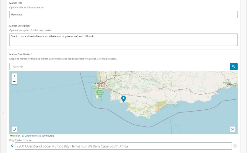
Each repeater row represents one destination.
For example:
Stop A — Arrival
Title
Robertson Wine Estate
Description
Start your weekend with a cellar tour and wine tasting.
Location
Selected using the OpenStreetMap field.
Stop B — Lunch
Oak Tree Restaurant
Enjoy lunch overlooking the vineyards.
Stop C — Accommodation
Valley Guest House
Check in before your afternoon walk through the surrounding vineyards.
Notice something important.
You’re writing normal website content.
You’re not thinking about coordinates, JavaScript or map configuration.
That’s exactly how I believe WordPress should work.
Editors should focus on content.
The plugin should handle the technical work.
Route Stops vs Points of Interest
Not every location belongs directly on the route.
Sometimes you simply want to highlight something nearby.
For example:
- Fuel station
- Parking area
- Visitor centre
- Coffee shop
- Information office
- Scenic viewpoint
These work perfectly as Points of Interest.
Instead of extending the route unnecessarily, visitors still discover useful places nearby.
It’s a small feature, but one that makes maps much more informative.
Displaying the Map
Once your route has been added, displaying it on your website is incredibly simple.
Baxtersweb Maps uses a shortcode.
In many cases you’ll simply place the shortcode inside your page, template or your preferred page builder.
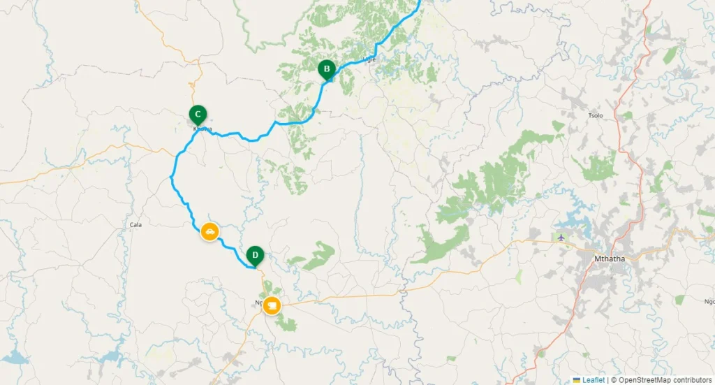
The plugin then:
- reads your ACF data
- creates the markers
- builds the route
- centres the map
- displays everything responsively
Because the map is generated from your content, any future edits automatically appear on the front end.
No duplicated work.
No rebuilding maps.
No copying coordinates between systems.
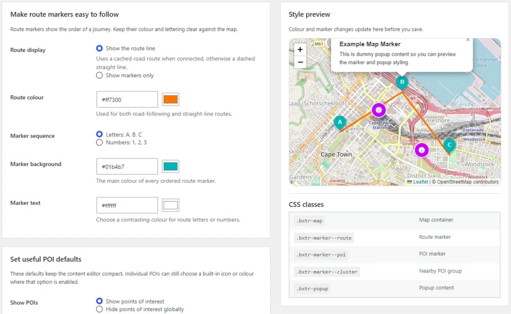
Customising the Appearance
Every website has its own visual identity.
A tourism business has different requirements to an engineering company.
That’s why Baxtersweb Maps allows you to customise the appearance without editing the plugin itself.
Depending on your project you can adjust things such as:
- Marker colours
- Route colours
- Number or letter styling
- Map height
- Label appearance
- Responsive behaviour
Small changes can make a surprising difference.
For example, matching the route colour to your brand immediately makes the map feel like part of your website instead of an embedded third-party component.
A Practical Example: Safari Itinerary
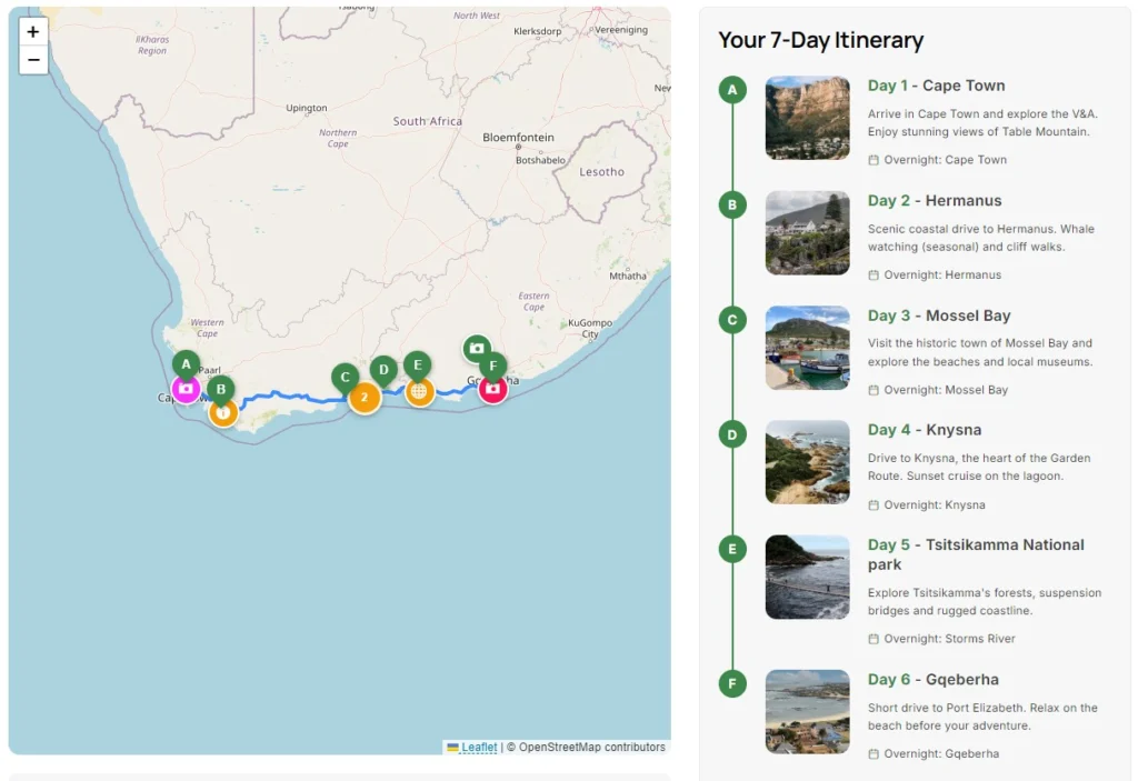
Let’s imagine you’re building a safari website.
Instead of creating a long page with photographs and paragraphs, visitors can follow the journey visually.
Your itinerary might look something like this.
Day One
- Arrival Lodge
- Afternoon Game Drive
- Sunset Lookout
Day Two
- Morning Safari
- River Crossing
- Bush Lunch
Day Three
- Rhino Reserve
- Departure
Every stop includes photographs and descriptions, while the map shows exactly where visitors travel throughout the experience.
It’s much easier to understand than reading several pages of text.
A Practical Example: Wine Producer Business
Interactive maps aren’t just for tourism.
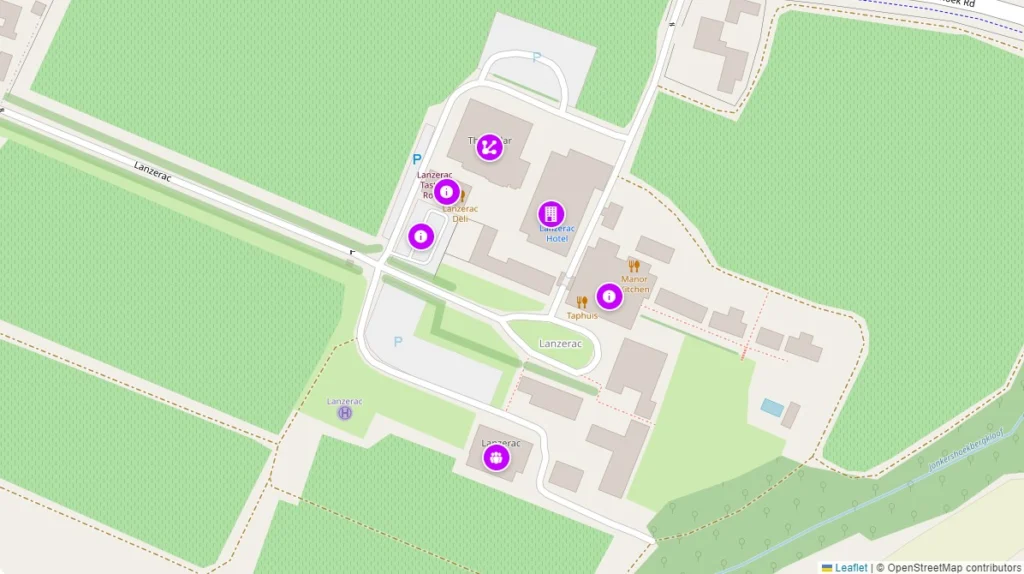
I’ve worked on wine producers websites where farms span large areas with multiple facilities.
Instead of a static aerial image, the map can guide visitors to:
- Main office
- The Cellar
- Hotel
- Restaurant
- Spa
- Parking
Seasonal contractors, suppliers and visitors immediately know where they’re going.
If facilities change, updating the map is simply a matter of editing the relevant WordPress page.
A Practical Example: School Campus
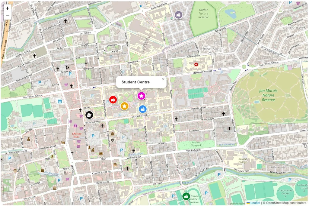
Schools often struggle to explain their campuses to prospective families.
An interactive map solves this beautifully.
Parents can explore:
- Reception
- Boarding Houses
- Classrooms
- Sports Fields
- Library
- Student Centre
- Auditorium
Instead of downloading a PDF map, visitors explore the campus directly from the website.
Why Structured Content Matters
This is probably the biggest lesson I’ve learned over the years.
Many websites start small.
Then six months later they become much larger than originally planned.
If your map exists as a manually created graphic, every update becomes a design task.
If your map exists as structured WordPress content, it simply grows alongside the website.
Need another stop?
Add another repeater row.
Need to update a description?
Edit the content.
Need to reorder the journey?
Drag the repeater rows into a new order.
The map updates automatically.
That might not sound revolutionary, but it saves an enormous amount of time over the life of a website.
Tips for Building Better Route Maps
Over the years I’ve found a few simple practices make maps much easier to use.
Keep stop names short
Visitors scan maps quickly.
“Visitor Information Centre” is much easier to read than a full paragraph.
Save longer descriptions for the content below.
Think about the journey
Don’t just plot locations.
Think about the order visitors experience them.
A logical sequence helps people understand the story you’re telling.
Use meaningful descriptions
Rather than writing:
“Stop 3”
Write something that tells visitors why they should care.
For example:
“Historic railway bridge with panoramic valley views.”
Avoid marker overload
Twenty carefully chosen locations are often more useful than one hundred tiny markers.
Maps should guide visitors, not overwhelm them.
Keep images consistent
If you’re displaying photographs alongside the route, use consistent aspect ratios and image sizes.
A clean presentation makes the entire page feel more professional.
Performance Considerations
Interactive maps don’t need to slow your website down.
Some simple recommendations include:
- Resize uploaded images appropriately.
- Optimise photographs before uploading.
- Only include locations that genuinely add value.
- Use caching where appropriate.
- Avoid extremely large datasets on a single page.
For most tourism, business and organisational websites, performance is rarely an issue when maps are planned sensibly.
Common Mistakes to Avoid
Here are a few things I regularly see.
Trying to do everything with one map
Large websites often benefit from multiple focused maps rather than one enormous route.
Using inconsistent location names
Choose a naming convention and stick with it.
For example:
- Day 1 – Arrival
- Day 2 – Safari
- Day 3 – Departure
This makes routes much easier to scan.
Forgetting mobile visitors
Many people will view your map while travelling.
Always check how your route behaves on smaller screens.
Treating the map as decoration
Your map should help visitors complete a task.
If it doesn’t add useful information, consider whether it’s needed at all.
Frequently Asked Questions
Can I use Baxtersweb Maps without coding?
Yes.
Once the required plugins are installed, you simply create your route content using familiar WordPress fields. The plugin generates the interactive map automatically, so you don’t need to write JavaScript or manually place markers.
Does Baxtersweb Maps use Google Maps?
No.
Baxtersweb Maps is built around OpenStreetMap and integrates with the ACF OpenStreetMap Field plugin.
This gives you a clean, flexible mapping experience while keeping your route information stored as structured WordPress content.
Can I create more than one route?
Absolutely.
Each page or post can have its own independent route, making the plugin suitable for websites with multiple itineraries, properties, tours or locations.
Can I add points of interest?
Yes.
Alongside your main route stops, you can also display nearby points of interest to provide additional context without affecting the route itself.
Examples include:
- Parking
- Fuel stations
- Viewpoints
- Accommodation
- Visitor centres
Will it work with my WordPress theme?
Yes.
Because the map is generated using a shortcode, Baxtersweb Maps is designed to work with most modern WordPress themes and page builders.
Can I customise the appearance?
Yes.
You can customise aspects such as marker colours, route styling and map dimensions to better match your website’s branding.
Is OpenStreetMap the Right Choice?
This is a question I get asked regularly.
The answer depends entirely on the type of website you’re building.
If all you need is a simple “Find Us” page with one location, almost any mapping solution will do the job.
However, if your website revolves around journeys, destinations or multiple locations, OpenStreetMap provides far more flexibility.
More importantly, it allows the map to become part of your content instead of something that’s simply embedded into it.
That’s a subtle distinction, but it changes how your website evolves over time.
Rather than maintaining maps separately, your route grows naturally alongside your content.
Who Is Baxtersweb Maps For?
Although the plugin is flexible, I built it with structured content in mind.
It’s particularly well suited to:
- Tourism businesses
- Safari operators
- Wine estates
- Schools and universities
- Agricultural businesses
- Event organisers
- Local attractions
- Property developments
- Municipal projects
- Businesses with multiple locations or visitor routes
If your website needs to tell visitors where to go next, rather than simply where something is, Baxtersweb Maps is likely to be a good fit.
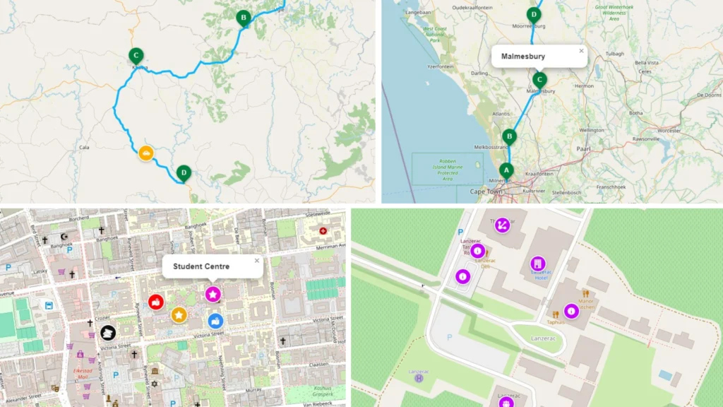
Final Thoughts
Interactive maps have become one of those features that visitors almost take for granted.
People expect to explore.
They expect to zoom.
They expect to understand a journey before they arrive.
The challenge isn’t displaying a map.
It’s making that map easy to manage six months or two years from now.
That’s exactly why I built Baxtersweb Maps.
Instead of manually creating graphics or rebuilding maps every time a route changes, the information lives where it belongs—inside WordPress as structured content.
If you already use Advanced Custom Fields, the workflow feels completely natural.
Add your locations.
Write your descriptions.
Choose your route.
Publish.
The plugin takes care of the rest.
Ready to Build Your First Route?
If you’d like to see Baxtersweb Maps in action before installing it, have a look at the live demo and documentation.
Whether you’re creating a tourism itinerary, a visitor guide, a farm map or an interactive campus, you’ll see how quickly structured content can become an engaging map experience.